


Chesterfield County’s Mountain
Sugar Loaf, a bump on the topo map
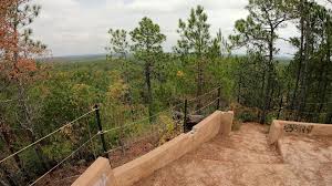
I remember as a child heading off to the “mountain”. Sometimes with my parents, other times with extended family & friends, and once on a school field trip. We’d see who could climb to the top fastest, spend time taking in the views of a never ending landscape, maybe enjoy a picnic down below, and running about.
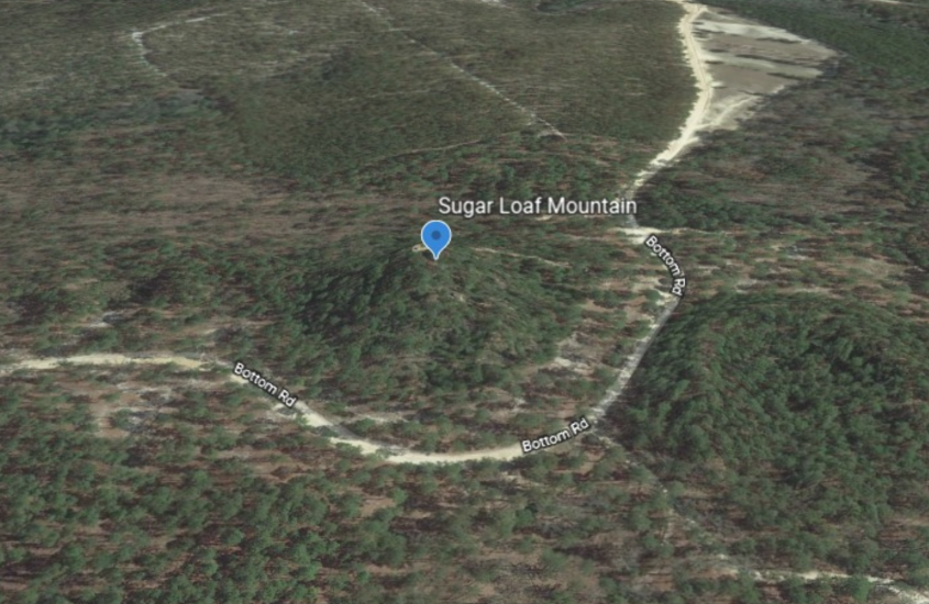
It wouldn’t be until later years that I’d have a renewed interest in the “mountain”, Sugar Loaf Mountain. Some spell it Sugar Loaf others Sugarloaf. Viewing it from Google Earth, its an interesting outcrop when compared to what lies around it. I think my level of interest is magnified by having visited the “mountain” many times in the past.
It’s in a quiet area of the Sandhills State Forest, a “forest” that spans over 45,000 acres. This bump on the topo map is part of the Middendorf Formation, which consists of sandstone, pebbly sandstone, sand, silt, and clay that has accumulated… making it an “unusual geological phenomenon”. The mountain enjoys some unique vegetation for the area, mountain laurel, and pixie moss.

For those who enjoy getting outdoors, you’ll appreciate the views, meandering wildlife, milky sand roads, and towering pines. Many who visit the area enjoy bird watching, horseback riding, camping, fishing, or hunting nearby.
Located on Bottom Road, off of Scotch Road, the “mountain” is a short drive from Patrick, Chesterfield, Hartsville, and Cheraw. An ideal destination for a day trip… especially during these unusual times.
Get out, load the family up, take in some sunshine, hike the mountain, descend, and enjoy a hydrating beverage. And then, take the long way home. There are miles of “dirt” roads in the forest. I remember riding them often with my kids, windows down, letting them take in the views and appreciate the land.
Shucks, I may head out to the “mountain” today…
By Rodney